


Guinea: Guinea Geography Profile
2015/10/04
Guinea - Topography
Guinea owes its frontiers mainly to the accidents of the late 19th-century partition of Africa and has no geographic unity. The country can be divided into four regions: Lower Guinea (Guinée Maritime), the alluvial coastal plain; Middle Guinea, the plateau region of the Futa Jallon (Fouta Djalon), deeply cut in a lot of places by narrow valleys; Upper Guinea (Haute Guinée), a gently undulating plain with an average elevation of about 300 m (1,000 ft), savanna country broken by occasional rocky outcrops; and the forested Guinea Highlands (Guinée Forestière), composed of granites, schists, and quartzites, inclunding Mt. Nimba (1,752 m/5,747 ft), the highest peak in the country, at the juncture of Guinea, Liberia, and Côte d'Ivoire. The Niger River and its significant tributary the Milo have their source in the Guinea Highlands; the Gambia River and Senegal River (whose upper course is called the Bafing in Guinea) rise in the Futa Jallon.
Guinea - Climate
The coastal region and much of the inland area have a tropical climate with a long rainy season of six months, a relatively high and uniform annual temperature, and high humidity. Conakry's year-round average high is 29° C (84° F ), and the low is 23° C (73° F ); its average rainfall is 430 cm (169 in) per year. April is the hottest month; July and August are the wettest. Rainfall in the Futa Jallon is much less (about 150–200 cm/60–80 in) and additional irregular, and temperatures are lower; moreover, the daily temperature range is much better, particularly during the dry season. In Upper Guinea, rainfall is lower than in the Futa Jallon; the average daily temperature range is as great as 14° C (25° F ), and better in the dry season. Rainfall in the highlands averages about 280 cm (110 in) annually; temperatures are relatively equable owing to the altitude, although with an average daily range of 18° C (32° F ).
Guinea - Flora and fauna
Dense mangrove forests grow along the river mouths. Farther inland, the typical vegetation of Lower Guinea is woodland dominated by parinari, with a lot of woody climbers and bushes below. Gum copal is common near streams. The Futa Jallon has been subject to excessive burning, and the lower slopes are characterized by secondary woodland, much sedge (catagyna pilosa), and expanses of laterite; the higher plateaus and peaks have dense forest, and some plants found nowhere else in the world have been reported on them. Savanna woodland characterizes Upper Guinea, with only tall grass in large areas; trees include the shea nut, tamarind, and locust bean. There is rain forest along the border with Liberia.
The elephant, hippopotamus, buffalo, lion, leopard, and a lot of kinds of antelope and monkey are to be found in Guinea, inclunding crocodiles and several species of venomous snakes. Birds are plentiful and diverse.
Guinea - Environment
Centuries of slash-and-burn agriculture have caused forested areas to be restored by savanna woodland, grassland, or brush. During 1981–85, some 36,000 ha (89,000 acres) of land were deforested each year. Between 1990-1995, Guinea lost an average of 1.14% of its forest and woodland area each year. Mining, the expansion of hydroelectric facilities, and pollution contribute to the erosion of the country's soils and desertification. Water pollution and improper waste disposal are as well significant environmental problems in Guinea. In 1994, water-borne diseases contributed to an infant mortality rate of 145 per 1,000 live births. The country has 226 cubic kilometers of renewable water resources with 87% used in farming activity. Only about 35% of the people living in rural areas do not have pure water. Guinea's cities produce about 0.3 million tons of solid waste per year. As of 2001, 11 of Guinea's 190 mammal species and 12 of its 409 bird species were endangered, inclunding 3 types of reptiles, 1 amphibian, and 29 of the country's plant species. Human encroachment and hunting have reduced Guinea's wildlife, particularly its large mammals, and overfishing represents a threat to the country's marine life. A nature reserve has been established on Mt. Nimba. Threatened species include the African elephant, Diana monkey, and Nimba otter-shrew.
Western Africa, bordering the North Atlantic Ocean, between Guinea-Bissau and Sierra Leone
11 00 N, 10 00 W
Africa
slightly smaller than Oregon
3,399 km
generally hot and humid; monsoonal-type rainy season (June to November) with southwesterly winds; dry season (December to May) with northeasterly harmattan winds
generally flat coastal plain, hilly to mountainous interior
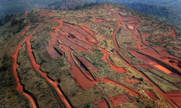
bauxite, iron ore, diamonds, gold, uranium, hydropower, fish, salt
hot, dry, dusty harmattan haze may reduce visibility during dry season
deforestation; inadequate supplies of potable water; desertification; soil contamination and erosion; overfishing, overpopulation in forest region; poor mining practices have led to environmental damage
the Niger and its important tributary the Milo have their sources in the Guinean highlands

- Guinea News
-
- GUINEA: Deadly Riots Again Grip Guinea’s Bauxite Hub
- CHINA: China to Loan Guinea US$20 Billion for Access to Bauxite Reserves
- CHINA: China to loan Guinea $20 billion to secure aluminum ore
- AFGHANISTAN: UNWTO: International tourism – strongest half-year results since 2010
- BOTSWANA: Why governments need to support the financial sector to meet the unserved needs of smallholder farmers
- BOTSWANA: International Arrivals To Africa Reach More Than 18 Million In 2017

- Trending Articles
-
- SOUTH AFRICA: Nigeria and South Africa emerge from recession
- BAHRAIN: Bahrain issues new rules to encourage fintech growth
- UZBEKISTAN: Former deputy PM named Uzbekistan Airways head
- ARUBA: Director of Tourism Turks and Caicos after Irma: Tourism, visitors, hotels current status
- ANGOLA: Angola: Elections / 2017 - Provisional Data Point Out Qualified Majority for MPLA
- WORLD: How fair is our food? Big companies take reins on sourcing schemes
.gif?1356023993 "Business Park of Mauritius Ltd, Mauritius")


